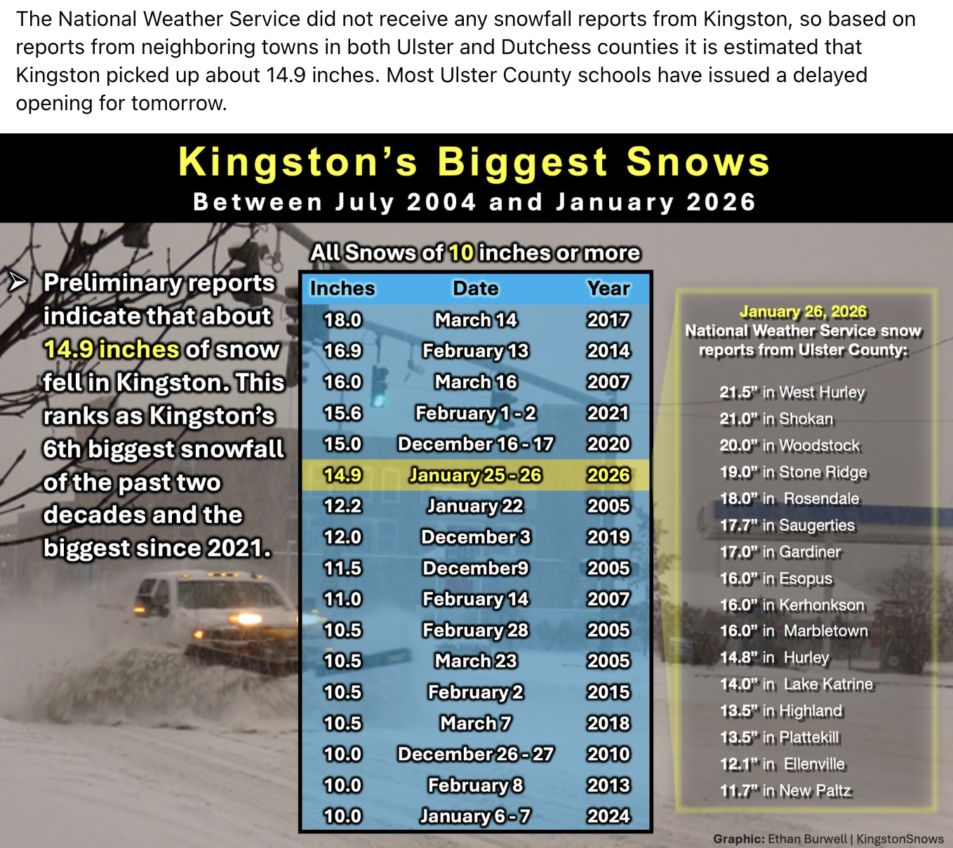
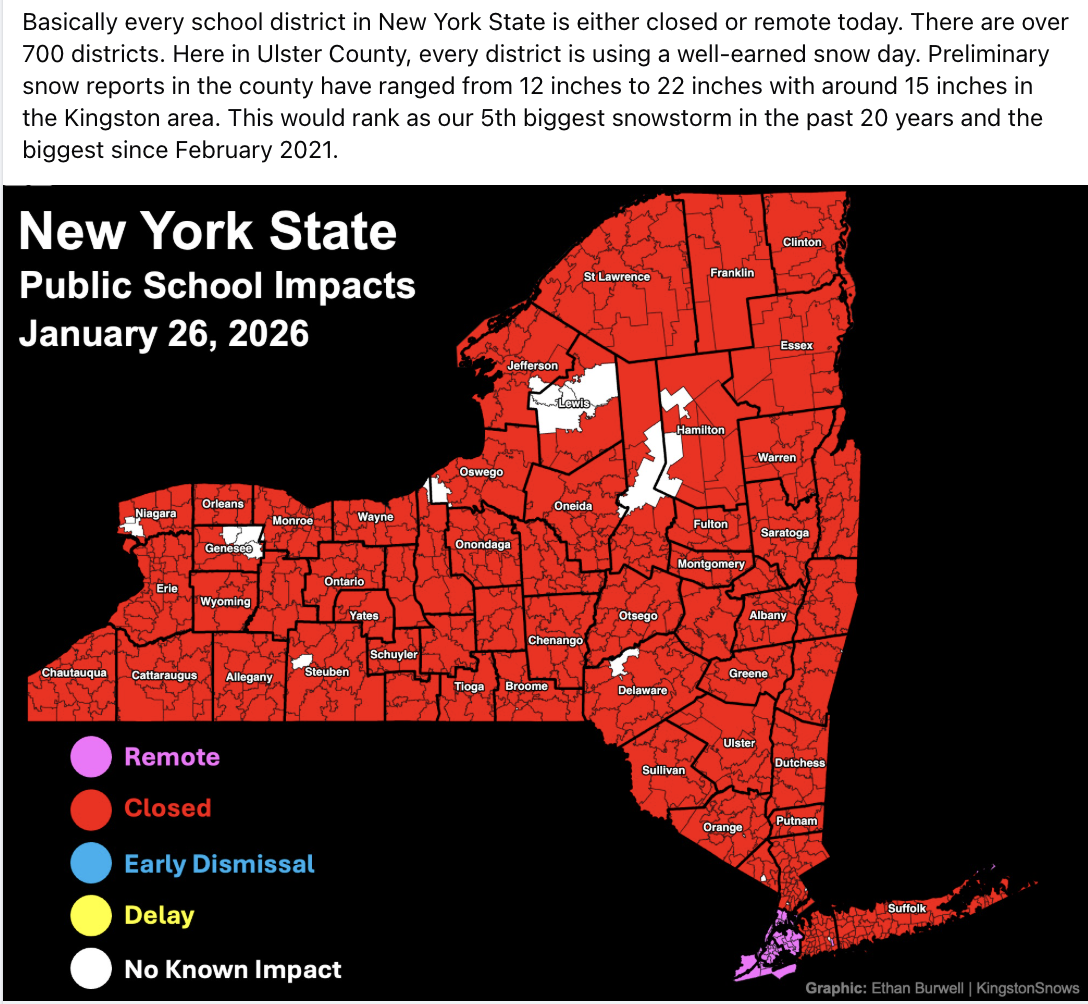
Snowstorm Ranks Top-10
School Forecast
for Tuesday January 27
Last updated: 6:00PM Monday January 26, 2025
| 60% (Medium) |
|---|
| 40% (Medium) |
|---|
| 0% (Nope) |
|---|
___________________
6:00 PM Monday:
The roughly 14.9 inches of snow that fell in Kingston makes this the biggest storm since February 2021 and our 6th biggest snowstorm in the past two decades. Light snow will linger this evening, this combined with temperatures falling from the teens right now to the single digits means that even plowed roads will remain slick. Kingston City School District has already issued a delay for tomorrow. Following the comparable December 2020 storm, Kingston City Schools issued a delay the day after snow ended dispite the City of Kingston continuing its Snow Emergency. A similar situation is likely tomorrow, so the probabilities favor a delay; however, with the lingering snow showers and slick roads an upgrade to a closing is possible.

___________________
Stay warm!
-Ethan 🙂
