Warning: this is an old update that has been archived. This update is not current.
Snow Tonorrow Morning
School Forecast
For Thursday February 6th
Last updated: 8:30PM Wednesday February 5, 2025
| 0% (Nope) |
|---|
| 100% (Yup) |
|---|
| 0% (Nope) |
|---|
___________________
8:30PM Wednesday:
No forecast changes. Roads quckly go downhill after 6AM/7AM. Snow ends by 11AM with intermittent light drizzle or sleet into the early afternoon. Enjoy the snow day tomorrow, and if you do have to travel, please be safe!
Our next storm will be Sunday - 4 to 8 inches of snow are possible. I'll have an update tomorrow.
-Ethan 🙂
___________________
4:00PM Wednesday:
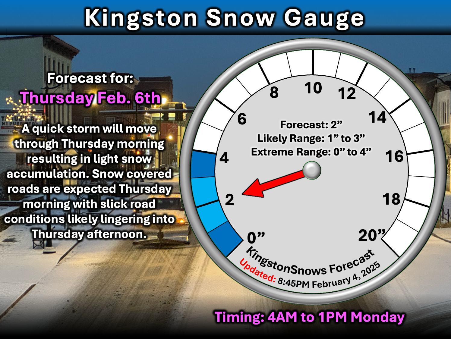
Really, no significant changes to the forecast since last night. Expect snow to begin between 5AM and 7AM. A four to six hour period of snow is likely with about two inches of snow accumulation. Snow will have no trouble sticking to roads and they will deteriorate quickly after 7AM. Expect snow covered roads for the morning commute. If you must drive, roads will be passable, but conditions will be poor. Following the brief period of snow, intermittent light drizzle or freezing drizzle will be possible from the mid/late morning into the early afternoon. Main roads may become just wet/slushy once plowed during this period, but side roads will likely remain slick.
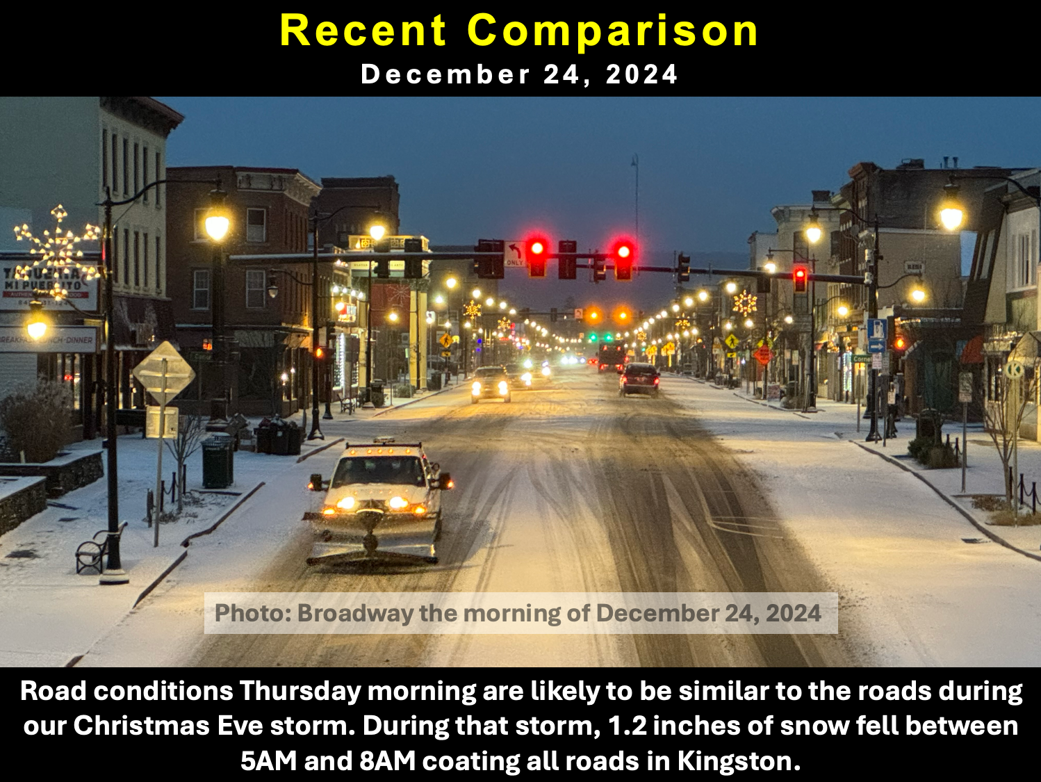
Still expecting the morning commute to be similar to the Christmas Eve snow, pictured below from last night's update. This will also be similar to how road conditions were with the snow that fell this past Sunday evening. As far as school impacts, this storm looks similar to the January 23, 2023 snow day. During that storm, Kingston recieved 2.2 inches between 7AM and 1PM. Temperatures started off much warmer during that storm, so districts across Ulster County initially issued delays, but then upgraded to closings at 7AM. A similar approach is possible tomorrow, but it seems more likely that schools will jump straight to a snow day tomorrow because temperatures will be starting off 10°F to 15°F colder than they did in the 2023 storm.
I plan to have one last quick update on this storm at 10PM tonight.
-Ethan 🙂
___________________
9:30PM Tuesday:
Our next winter storm will move through on Thursday. There is the potential for snow and sleet that will create hazardous driving conditions.

The Forecast:
The storm will approach the region Wednesday night. Temperatures Wednesday night will likely fall in to the upper teens. Snow is likely to begin falling in the Kingston area between 4AM and 7AM Thursday. A roughly four hour period of snow is likely after the storm begins. After that initial period of snow, intermittent light sleet or drizzle will be possible into the early afternoon. An inch of two of snow accumulation is likely and a light glaze of ice is possible. Temperatures will rise into the low to mid 30s Wednesday afternoon.

The Impacts:
With temperatures falling well below freezing Wenesday night, snow will have no trouble sticking to all surfaces when it begins Thursday morning. Snow coated roads are likely Thursday morning, and snow will likely be faling during the morning commute. Roads will be drivable, but slippery and hazardous. Roads that have been plowed may simply be wet and/or slushy by late Thursday morning. The potential for intermittent light sleet and drizzle will keep the risk of slick roads high into the afternoon. This storm looks to be similiar to the snow that fell on Christmas eve. During the Christmas eve storm, 1.2 inches of snow fell between 5AM and 8AM. Cold temperatures allowed snow to cover all roads in Kingston, including Broadway, meanwhile the Thruway was just wet. The main difference is that this storm has a better chance for sleet and drizzle to linger after the snow ends. Due to the timing of Thursday's storm, cancellations are more likely than delays.
I'll have an update tomorrow.
-Ethan 🙂