Warning: this is an old update that has been archived. This update is not current.
Snow Begins Tonight
School Forecast
For Monday February 10th
Last updated: 9:00AM Saturday February 8, 2025
| 20% (Low) |
|---|
| 0% (Nope) |
|---|
| 0% (Nope) |
|---|

___________________
8:30AM Saturday:
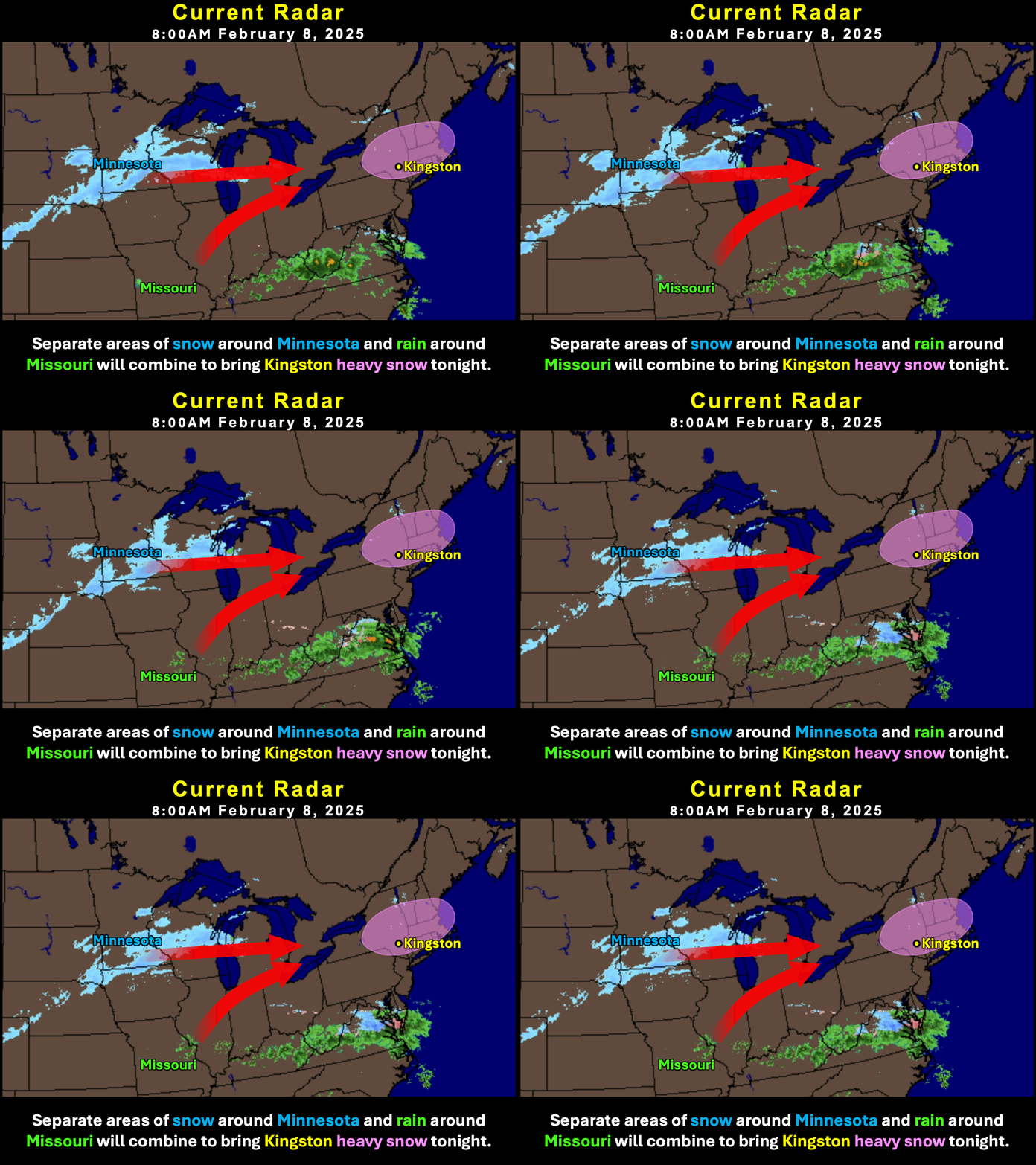
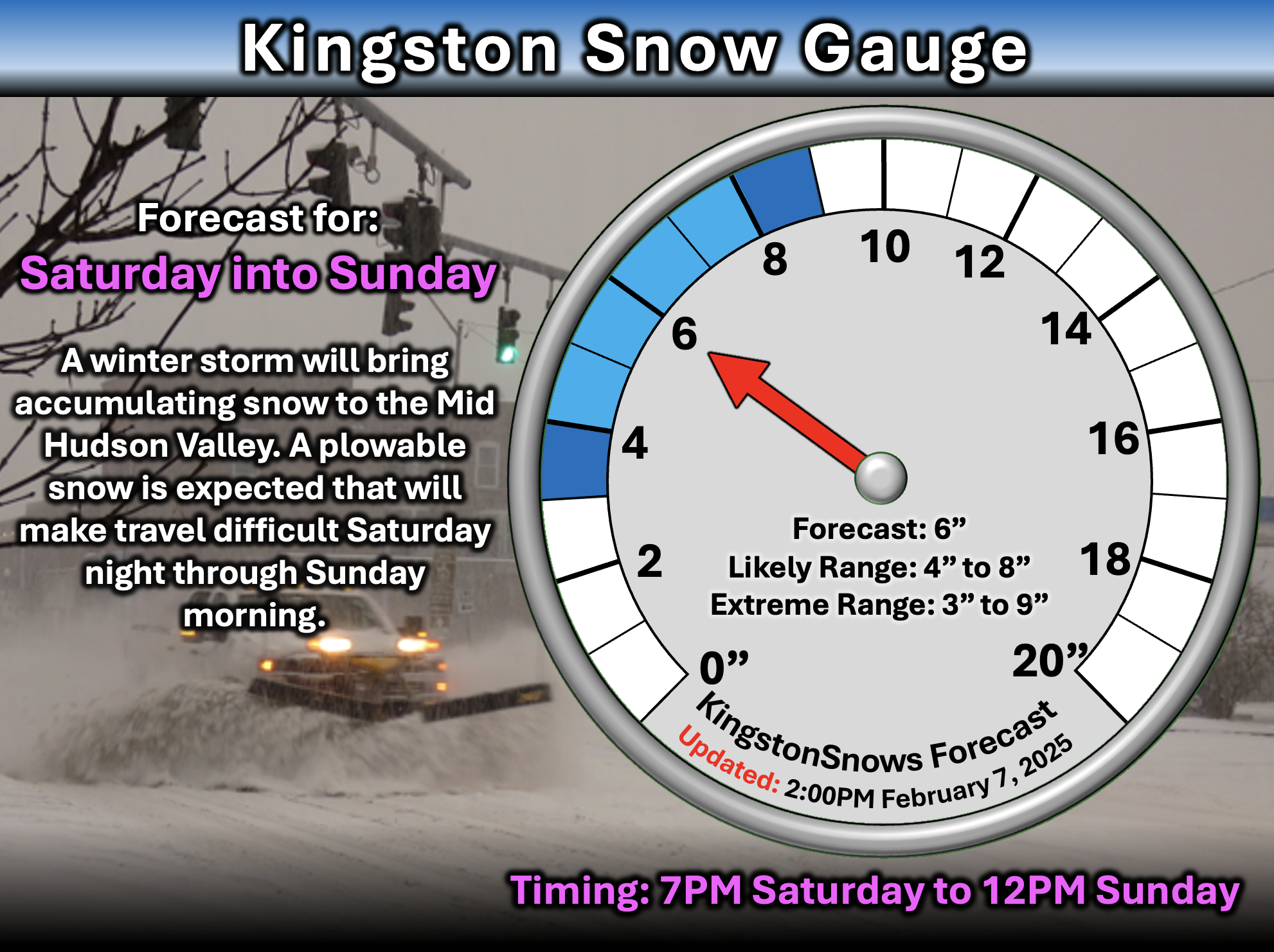
No functional changes to the forecast... A winter storm will bring moderate to significant impacts to the region tonight. The storm is currently organizing over the Mid-Western states. In Kingston, expect snow to begin around 7PM/8PM today. Steady snow over night may fall heavily at times. Snow may mix with or change over to sleet after 3AM Sunday. The storm should end around between 7AM and 10AM Sunday. Accumulations of 4 to 8 inches remain likely... the biggest limitng factor on the accumulations will be the amount of sleet that mixes in. More sleet = less snow accumlation, Less sleet = more snow accumulation.

The Impacts:
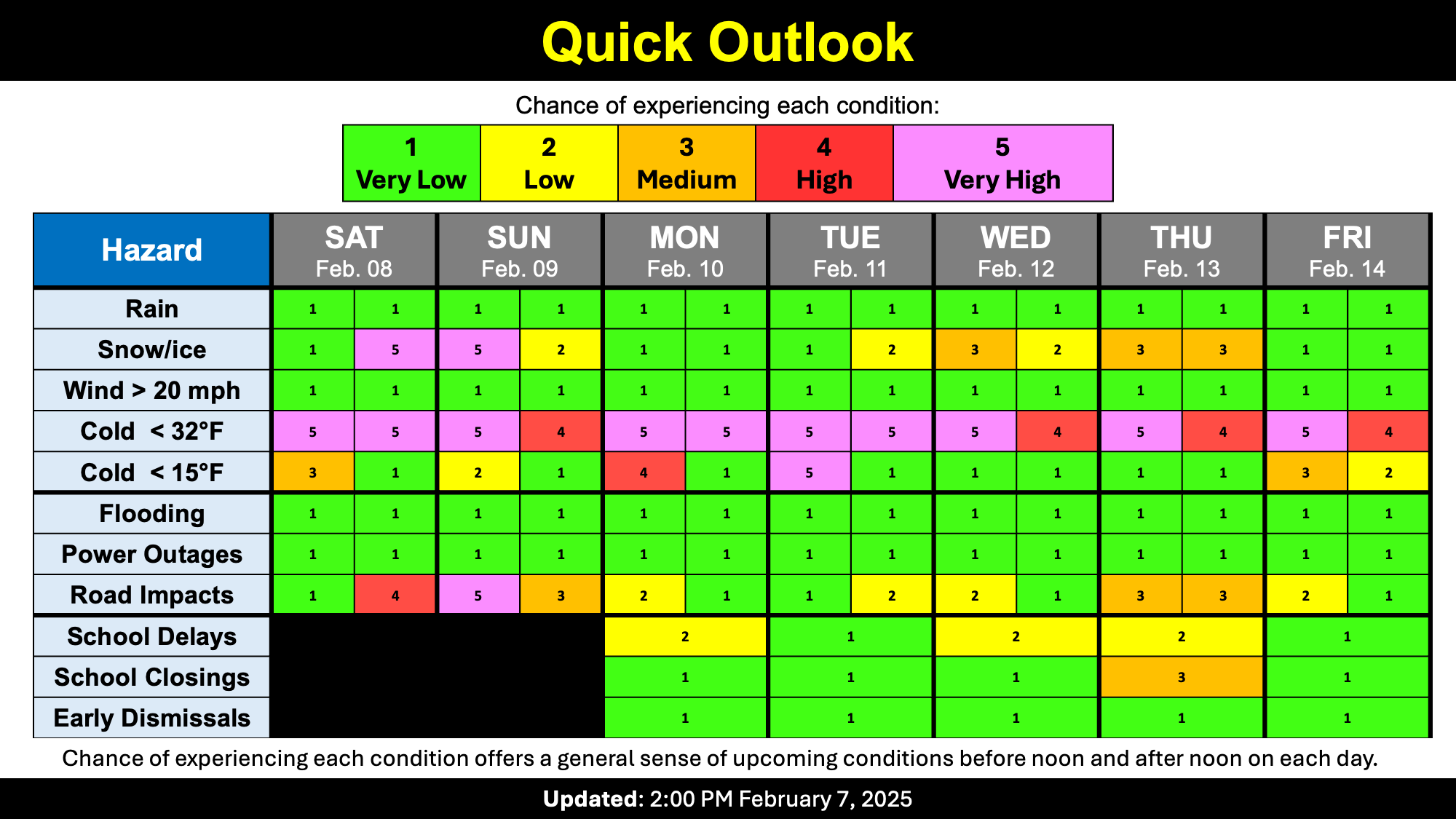
Roads will deteriorate rapidly after 8PM and be hazardous throughout Sunday morning. Temperatures should get a little above freezing on Sunday, so main roads may clear decently once plowed, but side roads may be slick through the afternoon. With temperatures likely to get above freezing Sunday afternoon, the storm ending relatively early, and the continued potential for lower-end snowfall amounts, school impacts continue to be unlikely on Monday but still can't be completel ruled out.
Unless there are significant changes, this will be the last update today. Tomorrow I'll reassess Mondau's school impacts and have a closer look at the other two storms that could impact us this week. Stay warm, be safe, and have fun with whatever falls tonight.
-Ethan 🙂
___________________
2:00PM Friday:
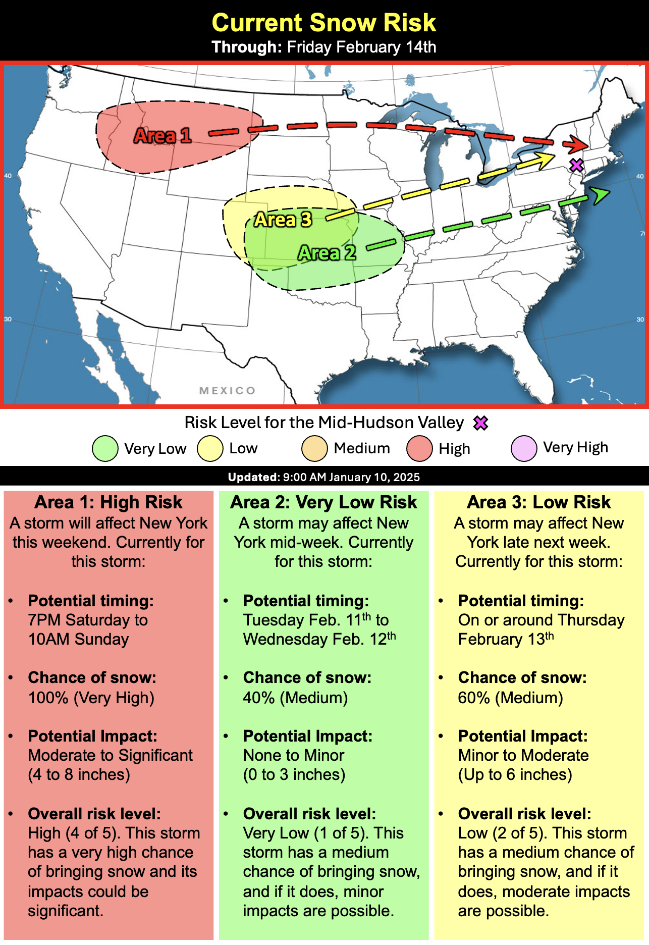
We are entering the most active week of the winter so far. Over the next seven days, three separate storms will affect southern New York and there is a good chance that Kingston gets snow from at least two of them - if not all three.
Storm 1: Saturday Night
There is high confidence that snow will fall across the entire Hudson Valley Saturday into Sunday.
Timing:
7PM Saturday to 10AM Sunday.
Amount:
4 to 8 inches of snow is very likely.
Impacts:
Snow covered roads Saturday night and Sunday morning. School delays on Monday are not likely, but possible depending on how much snow actually falls and when it ends. A comparable storm is the 7.2 inches that fell on on February 9, 2015. That storm produced 7.2 inches of snow Sunday evening through about 3PM Monday. Tuesday was a delay. This storm will very likely end earlier than 3PM and may have less than 7.2 inches of snow, so the chances of delays this Monday are less than they were in 2015.

Storm 2: Tuesday Night
There is low-to-medium confidence that snow will fall in Kingston as a storm passes to our south Tuesday-Wednesday. Snow is likely across NYC/Long Island, but Kingston will be on the northern edge and may or may not actually get snow.
Timing:
4PM Tuesday to 4AM Wednesday.
Amount:
0 to 3 inches of snow is possible.
Impacts:
If it snows, there is the potential for slick roads Tuesday night into Wednesday morning. School delays would be possible on Wednesday.
Storm 3: Thursday
There is medium confidence that snow will fall in Kingston on Thursday as a storm passes over the entire state.
Timing:
12AM Thursday to 7PM Thursday.
Amount:
TBD on amounts, but up to 6 inches of snow is possible at the moment.
Impacts:
Snow covered roads are possible Thursday; Schools would likely be cancelled.
Next Update:
Saturday Morning
-Ethan 🙂
